
Evidence: Large wave-flume experiment plus model-based geographical assessment.
Source dates: Paper published: 21 October 2026. Publisher announcement: 22 October 2026. Dataset made available: 24 August 2026, with temporal coverage spanning September 2023 to September 2024. These are separate from the Daily Wonder publication date.
A coastal marsh can look like a flat patch of muddy ground covered with plants. That simple appearance hides an important question: during a storm, do the ground and the plants keep protecting the coast in the same way?
New research suggests that we should separate those two parts rather than treating the marsh as one unchanging barrier.
What did researchers test?
The team moved 306 square metres of salt marsh into the Delta Flume, a large wave-testing channel in the Netherlands, and exposed it to significant wave heights reaching about 2 metres. Significant wave height describes the larger waves in a series, roughly the average height of the highest third, rather than the maximum individual wave. The researchers report that, after 21 hours of wave exposure, the average surface lowering was about 7 millimetres, while the vegetation suffered substantial damage. Less surviving vegetation meant less wave reduction attributable to the plants. Nature Portfolio research announcement Wageningen University & Research experiment summary · NOAA: significant wave height
The associated research-data record was made available on 24 August 2026 and identifies temporal coverage spanning September 2023 to September 2024. The October paper is therefore a new publication, not evidence that the experiment happened this week. Its data and code support the connection between incoming waves, exposure duration, vegetation damage and wave reduction, followed by a broader geographical assessment. Wageningen University & Research dataset record
What does the result mean?
Raised marsh ground and the roughness of its plants help take energy out of passing waves. If plants are damaged, their contribution can weaken even when much of the ground remains. These are different parts of the protection described in the publisher’s summary.
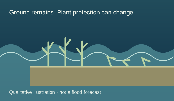
Two parts of a marsh can respond differently
- Raised ground remains
The flume experiment found little surface erosion during the tested wave exposure.
- Plants become damaged
Waves substantially damaged the vegetation even while the marsh surface persisted.
- One contribution weakens
Less surviving vegetation means less wave reduction attributable to the plants. Ground and plants need separate assessment.
Schematic explanation. Qualitative experimental explanation, not a protection percentage, coastal design or property-specific flood forecast. The geographical assessment also uses modelling.
The publisher’s summary says the vegetation’s strongest contribution was at lower-energy marsh coasts, with waves up to roughly 1 metre. It also discusses combining marshes with engineered defences in more energetic conditions. The result is not “plants stop all storm waves” or “marshes do not work”. The useful distinction is between different conditions and different protective mechanisms. Nature Portfolio research announcement
Why is that distinction useful?
Imagine testing a bicycle helmet after an impact. Asking whether its outer shape remains visible would not be enough: you would also want to know which protective functions remain. Similarly, an ecosystem can persist while one of the services we expect from it changes. This is an analogy about how to ask questions, not a physical model of a marsh.
It also shows why a single reassuring percentage can be misleading. “Reduces waves” needs context: which waves, for how long, across what kind of ground and vegetation? A good explanation keeps those conditions beside the result rather than hiding them in small print.
What are the limits?
This was an experiment and a model-based extension, not direct measurement of every coastline. Readers should not use a news article to choose a flood-defence design or judge whether their home is safe. Those decisions require local measurements and qualified assessment.
The accessible publisher summary and dataset were checked for this article. The full Nature paper could not be opened in the research browser, so this explanation does not claim a complete methods audit. Paper record
YOUR PERSPECTIVE
Join the discussion
What surprised you? Have a question or a correction? Share your thinking.
No comments yet. Start the conversation.
Sign in with ChatGPT to commentAnyone can read the discussion. Sign-in helps limit spam.